Log in
All resources
Create a design
Tools
308,624 Free Images of Pages With Maps
cc-zero
architecture
upopoy
lawn
pages with local camera coordinates and missing sdc coordinates
stübnitz
castle of rossena
mestre
uploaded with vicuñauploader
schmieritz
self-published work
pages with maps
self-published work
kršan
pages with maps
cc-zero
self-published work
mestre
self-published work
mestre
self-published work
mestre
self-published work
pages with maps
self-published work
pages with maps
self-published work
lawn
pages with maps
mombasa
pages with local camera coordinates and missing sdc coordinates
pages with maps
self-published work
pages with maps
self-published work
pages with maps
self-published work
pages with maps
animals
spring
self-published work
pages with maps
pages with maps
greifenberg
self-published work
roof
self-published work
roof
self-published work
pages with maps
self-published work
pages with maps
self-published work
pages with maps
uploaded with vicuñauploader
pages with maps
self-published work
pages with maps
pages with maps
cc-zero
self-published work
pages with maps
self-published work
pages with maps
self-published work
pages with maps
self-published work
architecture
self-published work
town
self-published work
perspective
interactive whiteboard
self-published work
self-published work
pages with maps
self-published work
pages with maps
self-published work
pages with maps
self-published work
grass
pages with maps
cc-zero
pages with maps
sidewalk
self-published work
pages with maps
landscape
nature
self-published work
pages with maps
self-published work
pages with maps
self-published work
architecture
self-published work
pages with maps
self-published work
pages with maps
self-published work
pages with maps
self-published work
pages with maps
self-published work
pages with maps
self-published work
landscape
self-published work
water
self-published work
pavement
self-published work
pages with maps
self-published work
pages with maps
self-published work
dark
self-published work
pages with maps
self-published work
lawn
self-published work
town
self-published work
architecture
self-published work
architecture
self-published work
architecture
self-published work
pages with maps
self-published work
pages with maps
self-published work
pages with maps
self-published work
water
self-published work
pages with maps
self-published work
water
self-published work
pages with maps
self-published work
dark
pages with maps
lawn
self-published work
architecture
self-published work
pavement
self-published work
metal
self-published work
pages with maps
self-published work
pages with maps
self-published work
pages with maps
self-published work
architecture
self-published work
maldives
self-published work
pages with maps
self-published work
pages with maps
self-published work
pages with maps
self-published work
pages with maps
self-published work
architecture
pages with maps
cc-zero
self-published work
pages with maps
self-published work
pages with maps
self-published work
pages with maps
self-published work
pages with maps
self-published work
pages with maps
self-published work
pages with maps
self-published work
pages with maps
sidewalk
houston
self-published work
pages with maps
self-published work
pages with maps
self-published work
architecture
self-published work
pages with maps
self-published work
pages with maps
self-published work
pages with maps
self-published work
lawn
self-published work
architecture
self-published work
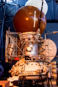
space exploration
6001 - 6100 of 308,624
Next page
/ 3087